Recently, a client of mine (who I used to do plenty of graphic design for) asked me for something a little different. Instead of the graphic design work that I’ve been doing for many years for her, she asked if she could commission a full painting from me instead.
Being unemployed and poor, I made sure to answer, “yes, of course I can do that”.
She’s also known me long enough to know that, when I’m not doing corporate, business-like graphic design work, that I’m a genre artist. But, she wanted a special painting, in traditional media, and she has faith in me to pull it off.
The commission, which is still in the works overall, is a painting from a trip she recently took to Corsica. It’s a beautiful place and, aside from the challenge of painting something from the area, I thought it would be a great way to do a different style painting (and have a real reason to do so).
She and her husband were on a yacht with many others, and they essentially started on one side of the island, visiting many ports. Other than the yacht being in the image, she gave me full reign to do whatever kind of painting I wanted.
There are beautiful geological formations all around Corsica, and in particular she had great shots of the area around Bonifacio. With the natural environment, the ocean, and the historical buildings there, I have plenty to work with.
But, being on the other side of the world (and, back to the “poor” part), it’s not possible for me to go there and take my own reference images. If I can, I love to go places and not just get reference photos, but really get a feel for the area. That helps me bring something to life that I hope is not just technically accurate (or close), but has the feeling of actually being there.
In lieu of the winning lottery ticket (wait… the other drawing is tonight), I turned to technology to help me. In this case, Google Earth.
Now, I’m sure everyone knows what Google Earth is, and if you don’t it’s no big deal. The trolley car will be along soon to pick you up, old chap.
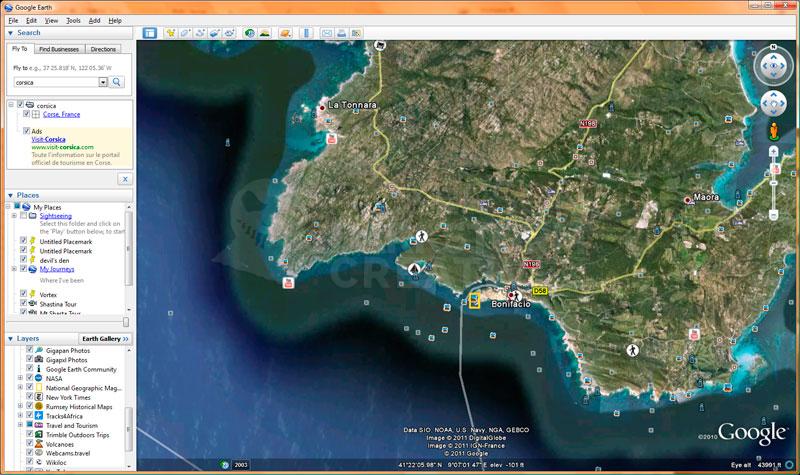
So, I entered Bonifacio into GE’s search box, and let her rip. It eventually zoomed in (quite quickly) to this:
Even with the multitudes of photos she gave me as reference, I can with GE get a decent grip on where it’s located. I can see the environment around it, and see that there are a bunch of other area photos. That’s the other nice thing with GE, that it links to photos, webcams, National Geographic and other content, even videos. It can be a treasure trove of information when you really need it, and you can’t get there easily.
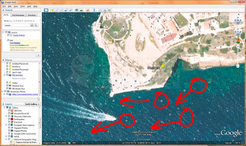
So I zoom in a little closer to the peninsula. I know from the client’s photos that they really liked the old part of town, hanging off the cliff as it does (go explore for yourself, here). From here, I can start getting an idea of where I want to have my point of view of the painting.
The general idea is to show the cliff with the old town on it on one side, the blue water from there all the way to the other side of the painting, and the yacht in the water. Below, you can see the red circles where the viewer would be looking from in the painting, and arrows for the general points of view. Note: the red is only for you fine folks, normally I don’t bother.
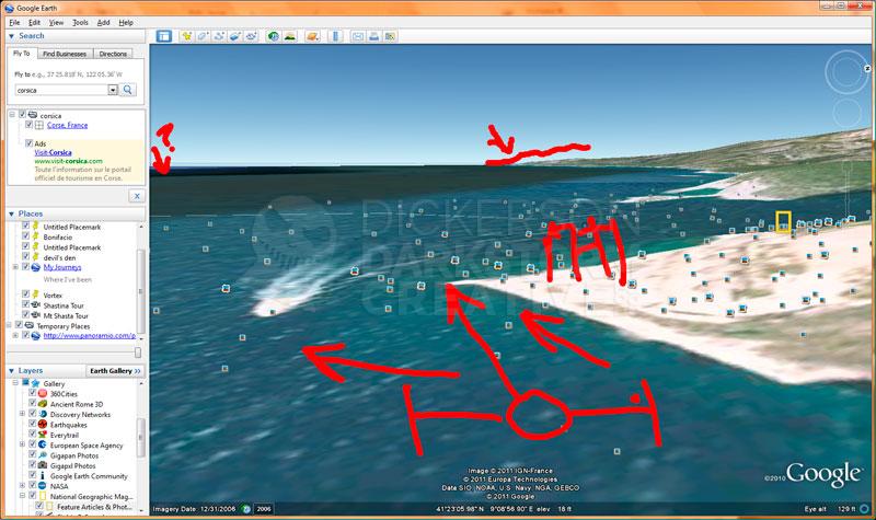
From here, I can tilt GE some so that it’s looking down the coast more. Tilting gives me not only a terrain view (if it’s available) and even sometimes 3D buildings (if someone happened to create them), but gives me a sense of what I’d see in the distance as well.
Depending on the angle I choose for the final painting, and how I crop it, I might see more of the coast down the way. If I did, I would just need more photo references, but that shouldn’t be too hard.
What might be more of an impact is the island next to Corsica, Sardinia. On GE, you can just see the tip of in the distance. Being a digital version, it’s not necessarily that easy to tell if you’d really see Sardinia from this spot, so I turned to GE’s measuring tools.
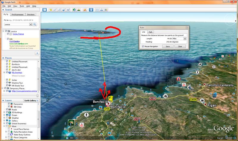
GE has a built-in ruler that will tell you how far things are apart. So I tilted the view back a bit so that I could actually see Sardinia and Corsica, and ran a ruler from my spot over to various parts of Sardinia.
While parts of Sardinia are closer, the part that would end up at the edge of the painting, from the viewer’s line of sight, would be around 40 miles away. It’s certainly possible, but unlikely, that someone at the water level would be able to see Sardinia from Bonifacio.
It might be still something to consider, and it’s something that I’ll take back to the client and ask them about. They really have been there, in this exact spot, and may have some insight on it. At this point, it may be cropped out of the image anyway once the final idea is set, but I’d still rather know, even if it’s off-canvas a bit, if it could be in there.
That leads back to how I am as an artist. Things might not appear onscreen, but that doesn’t matter. Those things can still affect what is onscreen, so must be taken into account. It’s like a painting of a woman dancing, where you can’t see her legs. Just because you can’t see her legs doesn’t mean they aren’t holding her up.
Overall, Google Earth isn’t going to do the job for me. But it might help me keep things straight, and keep them more accurate than if I was just painting it from scratch. It might even give me ideas for things to include or not to include, and maybe in the long run give me a better piece of art.
